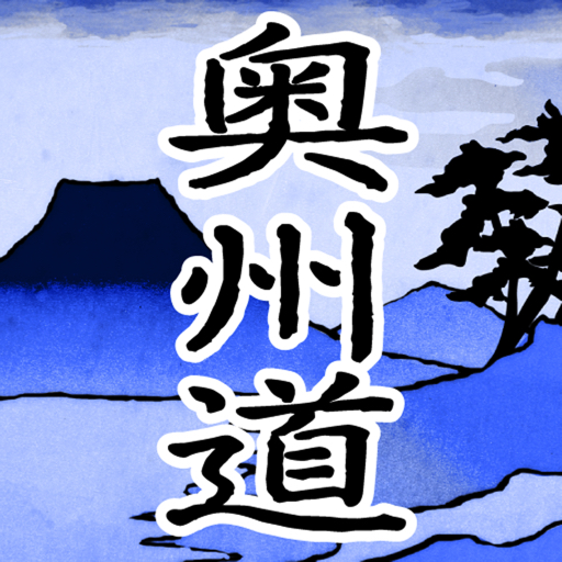
Features 奥州道中十次
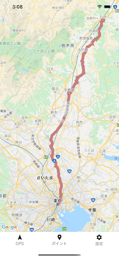
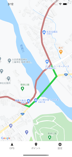
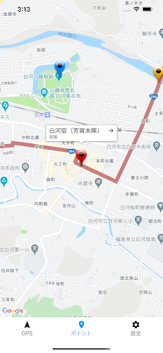
From UtsunomiyaShimotsuke Province (Tochigi Prefecture)Passing through Mutsu (Fukushima Prefecture),10th order to Shirakawa,There are 21 ri, 18 towns and 14 kens (about 85 km).You can trace and walk without hesitation using GPS.
You can also enjoy it by bicycle.
(The pass is impossible)On the map, I pointed out "post stations," "Ichirizuka," "famous places," etc.Now, launch the app and go on a highway walk !!This app points from Edo Nihonbashi to Shirakawa Onnaishi Oiwake.This application is a "shared growth application".The highway is alive.
Information will be updated from time to time as continuous updates.■ Display○ RouteThe old road is shown in red.Currently, the place where the old road has disappeared is displayed in "green" as a detour, butSmall detours due to being cut off by highways or railroad tracks are regular routes.○ Post stations / famous places, etc.The post station points to the "honjin".The information is "Gokaido Minute Encyclopedia" completed in the third year of culture (1806).It is based on the information in the "Yadomura Daishocho" that was investigated by Tenpo during the Ansei era (1840-50s).Since it is viewed from the perspective of the end of the Edo period, it does not cover famous places after the Meiji era.In addition, the names of the entrances and exits vary depending on the post station, such as "Mitsuke," "Kido," and "Stick Nose."In this application, it is unified to "Edo" and "Shirakawa".○ IchirizukaThose whose whereabouts are unknown are pointed out as "guesses".■ Main functions○ GPS buttonYou can turn on / off the GPS function on the map.○ Point buttonYou can show / hide all points on the map.○ Setting buttonDisplays application details, usage, advice, etc.
Social Features
Connect and share with friends and the community.
Gaming Features
Enjoy immersive gaming experience with various game modes.
Fitness Tracking
Track your workouts and monitor your health metrics.
See the 奥州道中十次 in Action
Get the App Today
Available for Android 8.0 and above